

L'ÊTRE SUPRÈME EN TERRE ROMAINE
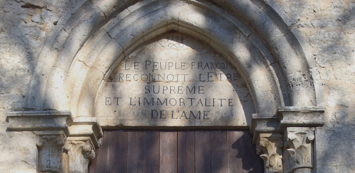
Discover the charms of the grove of Gatinais on this circuit connecting Remauville to Paley, between the landscapes of the Lunain valley and those of the Gâtinais plateau of Egreville, territories occupied since ancient times. Numerous historical testimonials mark out or near the route: the Pont Thierry, a Gallo-Roman work crossing the Lunain, a Merovingian sarcophagus, near the town hall of Paley, and the Saint Georges de Paley church, whose pediment bears the following inscription "The French people recognize the supreme being and the immortality of the soul".
USEFUL INFORMATION:
TRAIL DETAILS
TO SEE / TO DO NEARBY
In Paley :
Saint-Georges chhurch, the Pont Thierry (bridge), a Merovingian sarcophagus, the castle (XII - XVth).
In Remauville :
The Saint-Médard and Saint-Antoine church.
LABELS

Trace gpx
Download gpx track
Contact us
All of Moret Seine & Loing Tourist Office team is at your disposal.